In 2019 the Liverpool City Region Combined Authority declared a Climate Emergency. Since then, the mayor set out an ambitious vision for Active Travel to be the best place to walk and cycle in the UK. Liverpool City Region secured government funding totalling £70m to support active travel schemes and working with VivaCity has been key to accessing the funding.
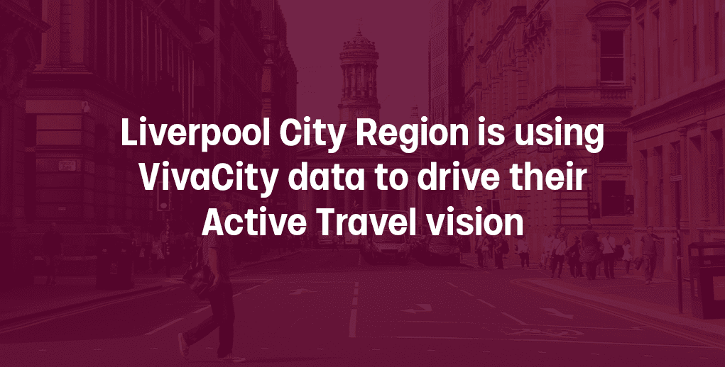
Find out how Liverpool City Region is using VivaCity data to drive their Active Travel vision.
The challenge
Liverpool City Region is working to make their bold Active Travel vision become a reality. The Combined Authority, like others in the UK, saw the number of people walking and cycling increase during the pandemic. Since then, Active Travel has dropped but remains above pre-pandemic levels.
However, the aim is to get more people to walk and cycle, not just keep numbers as they are. In order to succeed, the authority needs evidence to understand the impact of their schemes to:
- Build what works. Evaluate which schemes work and continue building.
- Make the case. Showcase the return on investment and make a case for more funding.
- Mythbust. Convince communities who are vocal against reallocating public space for active travel using independent, trustworthy data sources.
The solution
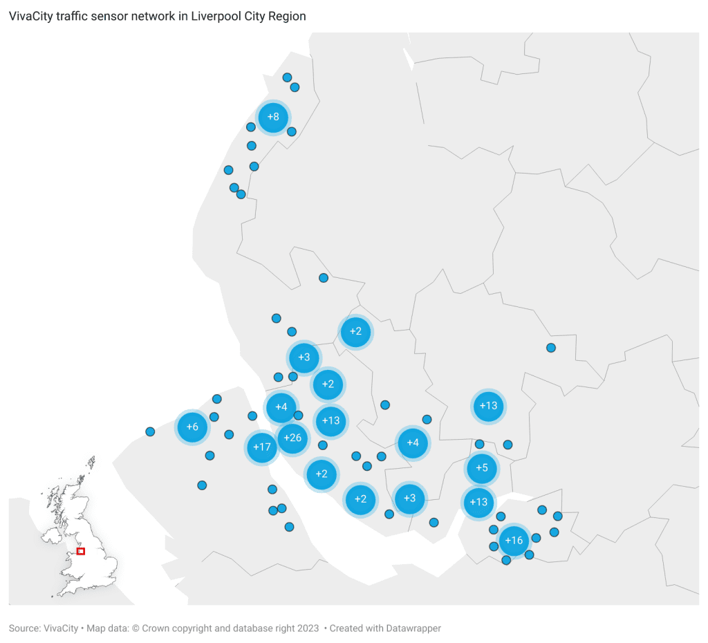
Liverpool City Region chose to work with VivaCity to grow their evidence base on the transport network. Since 2019, the authority has installed ~190 traffic monitoring sensors across the region with a further 40+ in development.
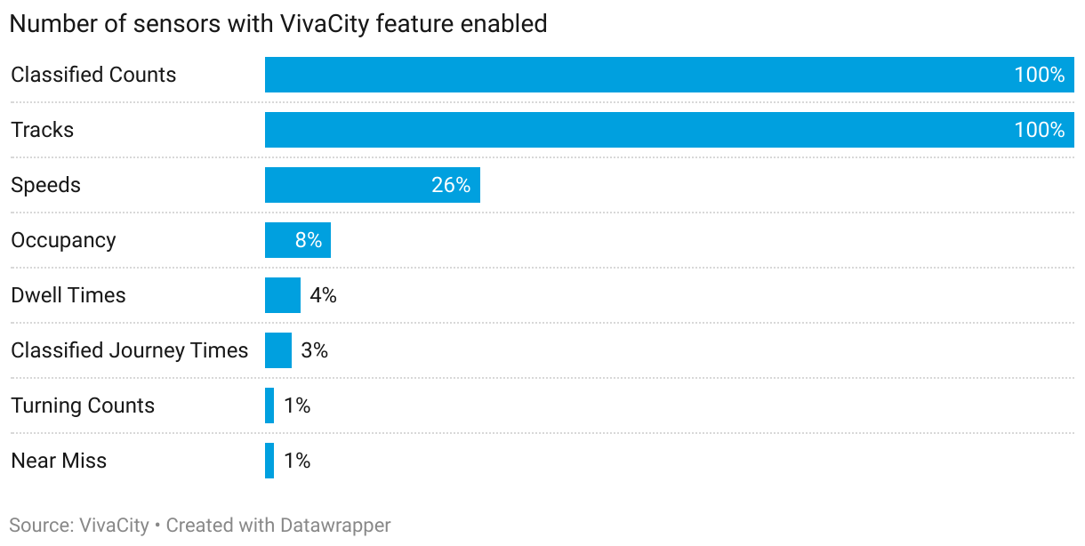
VivaCity sensors have a wide range of capabilities from e-scooter detection, counts, speeds and more. This allowed Liverpool City Region to optimise data collection and select locations that support use cases beyond active travel. All of its sensors provide multi-modal data on traffic flows (Classified Counts) and path movements (Tracks). About a quarter collects speed data to understand safety issues. Some locations have also been set up with features such as Dwell Times, Occupancy, Journey Times, Turning Counts or Near Miss.
The outcomes
Understand what works
VivaCity data has enabled Liverpool City Region to evaluate Active Travel schemes and understand what works. For example, the authority was able to demonstrate good compliance of cyclists on shared active travel infrastructure in Childwall. VivaCity tracks data showed that cyclists were generally sticking to dedicated cycle paths on the road space. This has informed further investment to expand the City LCWIP Corridor.
Cycle Tracks, Childwall (13/09/2023 7:00-9:00)

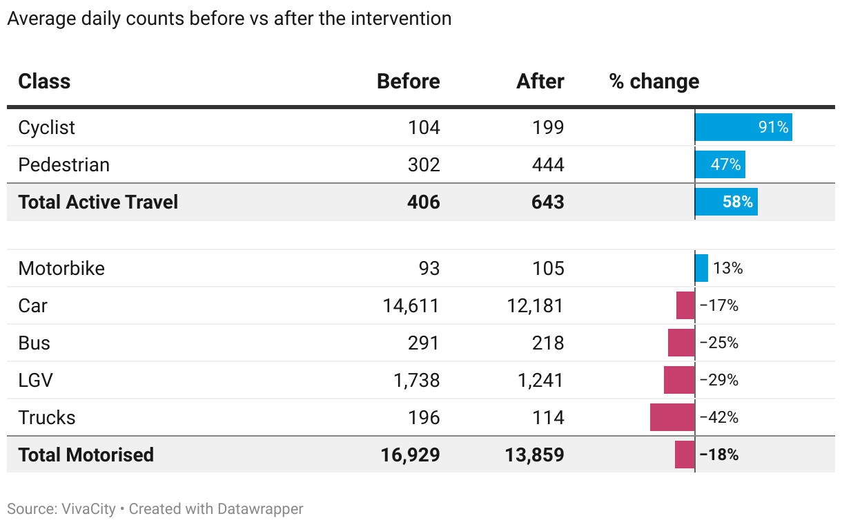
At another site, Liverpool City Region implemented a segregated cycle lane on two sides along a busy carriageway. VivaCity Classified Counts data was used to evaluate the scheme. Comparing data before and after showed a notable increase in active travel users as a result of the new design. Daily cyclist numbers almost doubled (+91%) and the number of pedestrians went up by 47%. The proportion of active travel makes up 4.4% at the site, up from 2.3%.
Make cycling safer
VivaCity data has also helped to inform the design of new Active Travel schemes aimed at making cycling safer and promoting modal shift.
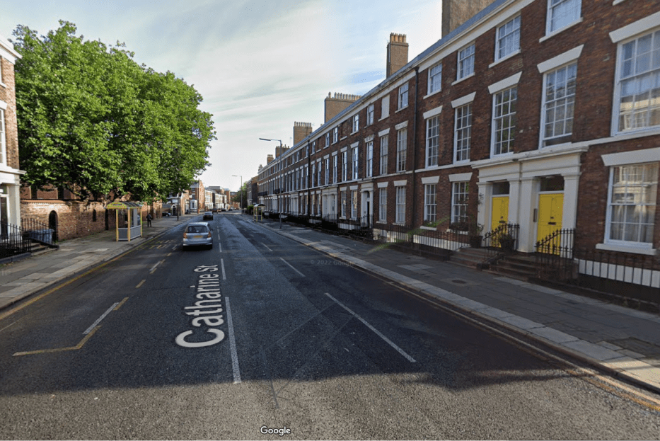
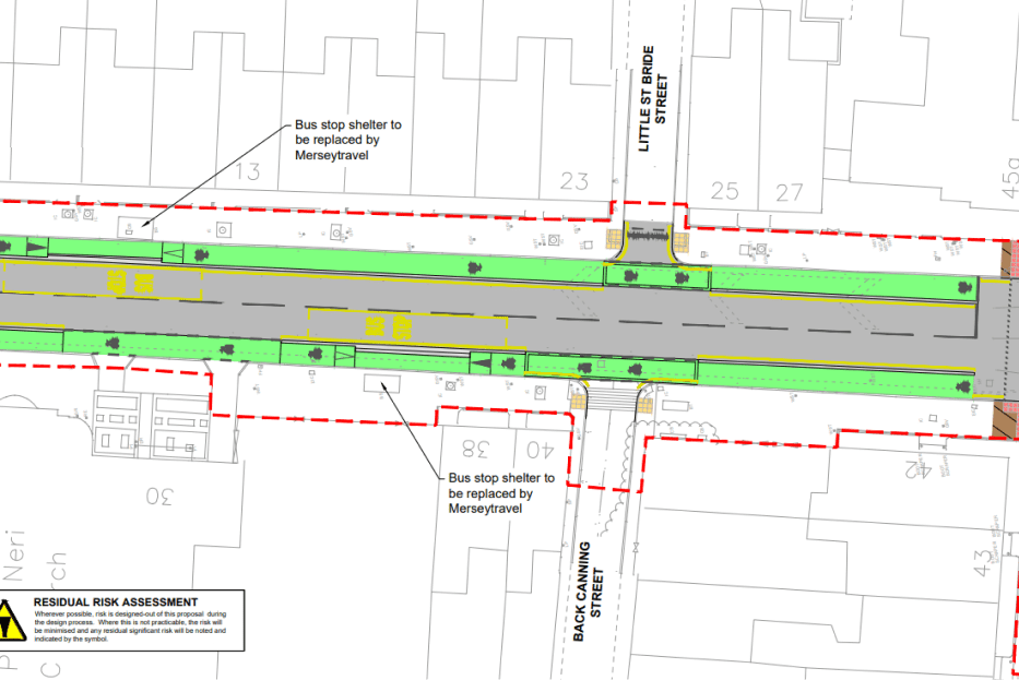
In July 2024, Liverpool City Council started the development of a £2m Active Travel scheme at Catharine Street. The site is a four lane road link in the city centre with around 8,000 vehicles and 400 cyclists a day. Catharine Street has a speed limit of 30mph but vehicles often exceed this. The scheme will introduce a segregated cycle lane on both sides and connect cyclists to a wider corridor of cycle routes.
Catharine St – current
Catharine St – plan
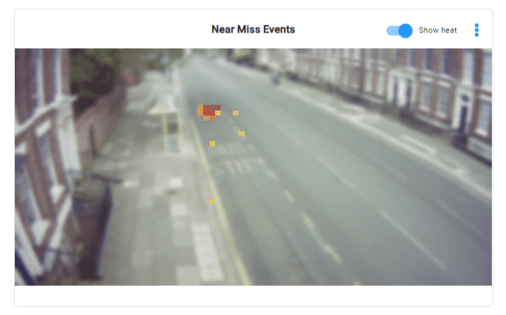
Liverpool City Region installed a VivaCity sensor on Catharine St to help inform the final design. A range of data sets enabled the authority to understand key issues at the site.
- Near Miss: Heatmap and video footage highlighted issues with vehicles overtaking cyclists at fairly high speeds due to the ability to swerve into the outside lane.
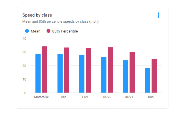
- Speeds: Data showed relatively high average speeds and proportion of vehicles above the speed limit.
- Tracks: Cyclist movements did not indicate any issues or conflicts.
- Dwell Times / Journey Times: Data sets will help to monitor bus reliability moving forward.
Catharine St, Near Miss events heatmap
Catharine St, average speeds by class
What next
VivaCity data has been crucial for the Liverpool City REgion in developing their Local Cycling and Walking Infrastructure Plan (LCWIP) and accessing Active Travel funding. The authority aims to keep growing the evidence base to drive their active travel goals. Building on the large sensor network, it is now looking to build their first walking and cycling model. This will help to understand current and future demand for new infrastructure.
“VivaCity data gives us the confidence at the Combined Authority to develop and implement well designed schemes that drive a shift towards more sustainable modes of transport. It’s having this robust evidence that is enormously beneficial to show the work that has been done and encourage further investments to continue the journey we are on.” – John Smith, Principal Projects Officer, Liverpool City Region
Get more from your technology with VivaCity’s 3-in-1 solution
With ongoing pressure on budgets it’s important to make the most of any technology you deploy. Versatility is key. VivaCity sensors can be used for three purposes: road safety, signal control and traffic monitoring. VivaCity sensors are always connected, so there’s no need to add all features at the point of installation – you can add them as and when they’re needed. When used in combination, the datasets unite to provide holistic and fully comprehensive insights and performance metrics, all from the same sensor.

Explore VivaCity’s range of capabilities:

Discover What Makes VivaCity’s AI-Powered Computer Vision Sensor Technology Unique
Like our content? Sign up to our newsletter and receive the latest updates in your inbox.