By Mark Nicholson, VivaCity’s CEO and founder
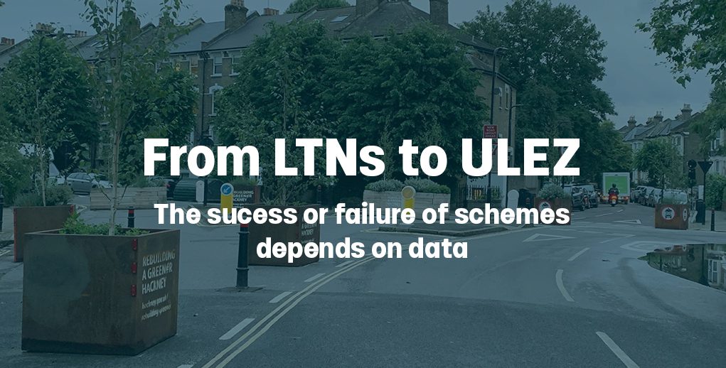
The implementation of low-traffic neighbourhoods (LTNs) has been met with both critique and encouragement, with the UK Prime Minster calling for a review. This also comes alongside the recent ULEZ expansion into Greater London.
There are two sides to the coin. On the one side, these schemes are well-intended and have the potential to reduce congestion, emissions and pollution while making roads safer. On the other side, they could be used very little by sustainable travel modes and simultaneously cause greater congestion – and therefore pollution – with rerouted traffic in surrounding areas.
As such, regardless of whether councils and boroughs opt for LTNs and ULEZ, data-driven decision-making is essential. Without it, these schemes are much more likely to fail.
Why interventions and schemes fail
A common trait of schemes that fail is low-quality data, with councils not having access to accurate, reliable and timely information. This starts at the beginning. If you do not have detailed data on how roads are being used (for example, by what travel modes and how often) and current pollution levels, then it is incredibly hard to design a scheme to have its intended impact.
When schemes are up and running, it is just as important to make sure their use is constantly monitored. An intervention could lead to an initial surge in activity for cycling, for example, but then this reverts back to ‘pre-scheme’ levels later down the line. Without real-time data and an ability to accurately measure different travel modes, it becomes difficult to have reliable insight on how a scheme is being used.
Above all, data provides evidence. This is objective insight that can, firstly, inform decisions on how to implement schemes and whether to keep them; it can then, secondly, be relayed back to policymakers and stakeholders to underline the reasons for decisions and changes. Without it, it is far easier for a scheme to fail due to design faults, public criticism and ultimately a lack of proof.
How can this data be gathered?
From induction loops to maps technology and AI sensors, there are a variety of methods used to collect data. What is crucial is adopting tech that is able to provide accurate data in real-time, enabling the measurement of day-to-day trends and also building long-term datasets. Together, this tech can be used to assess both micro-level trends specific to a scheme and macro-level trends on a wider scale and area.
For example, AI sensors can be placed at specific sites to anonymously classify and measure in real-time different modes of travel, tracking counts (for instance, eight cars and six cyclists), speeds and pathways. Corresponding technology such as pollution sensors can then be used in collaboration with this tech to see the broader, holistic effects of the scheme. Combined, these technologies can gather a large and detailed dataset into changing – or not – travel trends in the local area and city.
A real-time, adaptable approach
It is hard to adopt a blanket approach to LTNs, as each scheme will be specific to its locality and the surrounding area. By analysing comprehensive data on traffic flow, road congestion and pollution levels, councils can make data-driven choices that align with their borough, town or city’s unique requirements.
Data not only guides decisions on where and how to implement infrastructure changes, but allows for the continual adaptation of schemes and helps to plan and predict future upgrades. This approach ensures efficient allocation of resources, minimal disruption to residents and maximum positive impact on the environment.
Policies will inevitably be met with those applauding and critiquing their implementation. Data arms decision makers with evidence. It can demonstrate if changes are being used by sustainable travel users, how they’ve affected interactions with other road users, and help determine whether they have contributed to a modal shift in travel or reduced pollution levels.
Without it, councils will be unable to make informed decisions that will ultimately help residents, visitors and businesses. If we are to find the right policies to build a sustainable future, and as the LTN debate is sure to rumble on, real-time data is the steady constant paving the way for decision makers.
3-in-1 solution with Smart Traffic tools
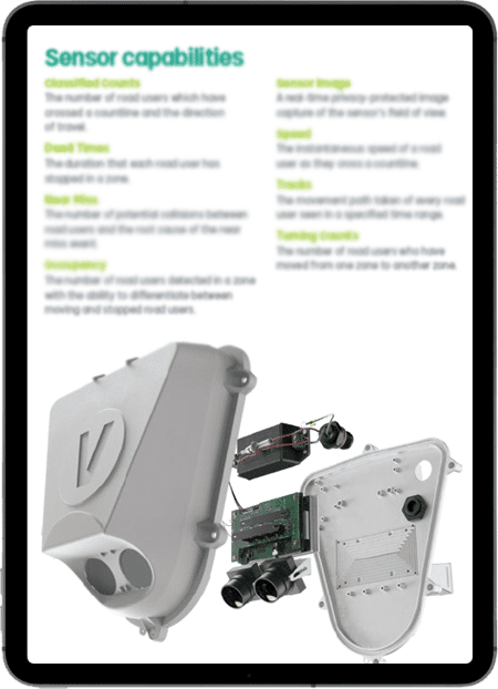
With ongoing pressure on budgets it’s important to make the most of any traffic technology deployed. Versatility is key. VivaCity sensors can be used for three purposes: traffic monitoring, signal control and road safety. VivaCity sensors offer a variety of multimodal road user data – including tracks, speed, turning counts, near miss collisions, etc, all from a single sensor -, and the data is available in real time 24,7, with an independently verified accuracy rate of 97%. Our sensors are always connected, so there’s no need to add all features at the point of installation – you can add them as and when they’re needed.
Explore VivaCity’s range of capabilities:
Discover what makes VivaCity’s solution unique
Like our content? Sign up to our newsletter and receive the latest updates in your inbox.