VivaCity COO, Peter Mildon, discussed our new Near Miss capability, which enables insights into high risk areas of the road space, at the recent Road Safety GB Conference.
On 1st March, VivaCity’s COO, Peter Mildon, spoke at the annual Road Safety GB Conference, Joining the Dots. Now in its 7th year, the event provides support and guidance for the road safety profession and this year focused on the potential for data to transform our understanding of road safety.
Peter spoke about VivaCity’s new Near Miss feature that uses improvements to our computer vision’s ability to accurately track the path of vehicles to generate statistics on Near Misses, and help investigate their root cause.
Limitations of existing road safety data
Assessing the safety improvement of a specific road scheme in a statistically significant way using existing road safety data is currently challenging due to the small sample size of accident data over the time frame of a scheme’s assessment. Furthermore, the process of making road safety improvements is often a reactive one, instigated by accident data after the fact, rather than trying to predict where accidents might occur next. It’s also not always possible to identify the cause of a crash to the extent that’s required for an intervention to be actioned.
How AI can help our roads become safer for all
Computer Vision based AI can provide comprehensive insights to proactively guide safer road design. Since 2016 VivaCity have been developing computer vision technology to equip transport authorities with accurate, GDPR compliant, road use data, on all types of users – from the most vulnerable modes like pedestrians and bicycles, to buses and HGVs, as well emergent modes, like e-scooters, which are presenting new challenges to existing infrastructure and road safety legislation. With AI we can identify the accidents waiting to happen and save lives.
VivaCity’s Near Miss capability
With advanced 3D detection capabilities, VivaCity’s new Near Miss feature makes it possible to identify accident hotspots and investigate their root cause.
By combining speed and path datasets, and analysing the post-encroachment time of vehicles as they cross a single point, near miss data reveals the riskiest areas of a road space to inform proactive safety interventions.
A new dimension
The neural networks we initially developed for our sensor technology identify vehicles as 2D boxes. Tracking follows the bottom centre of the bounding box and the paths are skewed as a result. Whilst this is fine for counts and path data, to accurately gather near miss data we needed a much more accurate method of obtaining track data.
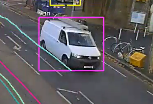

Light blue line in both images above shows skewed path tracking
We have developed 3D capabilities to solve this problem. This gives more precise localisation enabling us to accurately trace the projection of the object’s footprint on the ground.

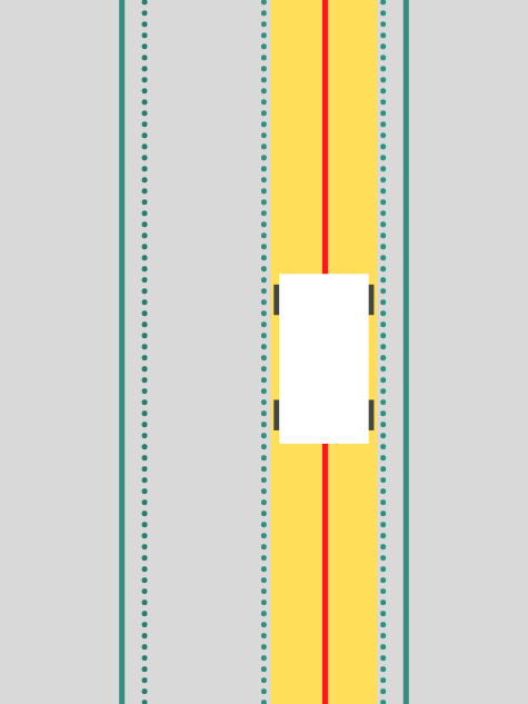
Red line above shows centred path tracking
What Near Miss is and what it’s not
We also considered the definition of what a near miss actually means. Our initial hypothesis was to use proximity – for example, measuring the passing distance between a cyclist and a lorry – the shorter the distance the greater the risk. But this was quickly dismissed because when cyclists pass parked lorries, distances would be short but risk low.
Velocity also needed to be incorporated. Mapping out projected paths to indicate how far in the future a collision might happen worked well for incidents like rear-ending, but in reality, projected paths do not often cross.
The winning formula was the analysis of Post-Encroachment Time. This is the difference in time between two road users – vehicles, pedestrians or cyclists – occupying the same point in the road space. A post-encroachment time threshold is set in order to quantify a near miss.
Using anonymous path data also offers the additional benefit of being a GDPR compliant alternative to CCTV in efficiently finding the root cause of the road hazard.
What’s next for our road safety Near Miss work?
Whilst a generalised approach to near miss analytics is scalable and comparable across locations, a site specific bespoke analysis can often add a deeper understanding of the root cause of a local hazard.
“Our current approach is to offer a combination of generalised near miss statistics that can enable multiple sites to be compared, alongside a more bespoke and consultative approach of using path data to understand the details behind the localised hazard.
We are continuing to research the holy-grail AI, which would be able to offer the bespoke local hazard identification in a generalised way!”
Peter Mildon, COO, VivaCity
Please contact us to find out how our Near Miss capability can help with your road safety projects.
Learn more about how data and insights can power up your road safety schemes.
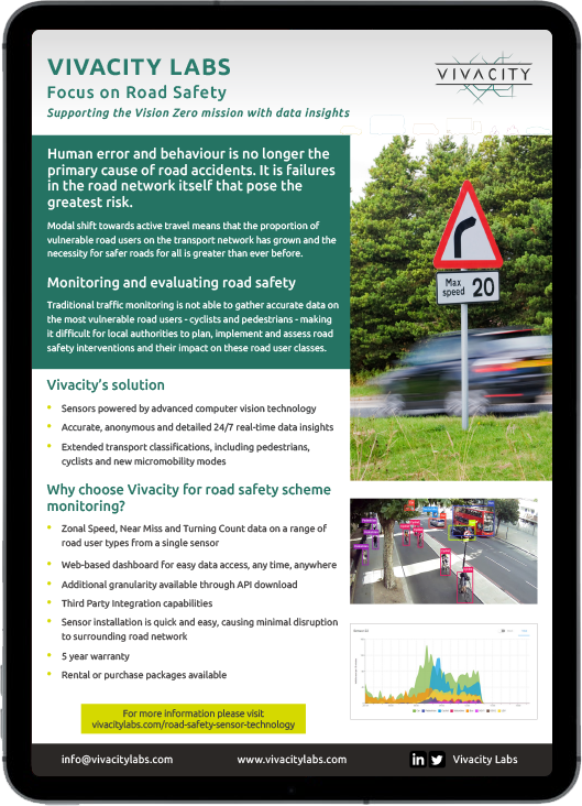
Download our Road Safety scheme monitoring brochure now
Like our content? Sign up to our newsletter and receive the latest updates in your inbox.

