Local authorities rely on after-the-fact KSI data to make road safety decisions
Someone is killed or seriously injured on UK roads every 16 minutes.
To achieve Vision Zero goals the rate of road casualty decline needs to double, alongside the perception of road safety for cyclists and other sustainable modes.
Traditional road safety management has relied on reactive action, based on after-the-fact data. This approach will not achieve the Government’s safety targets.
The future of proactive Road Safety management
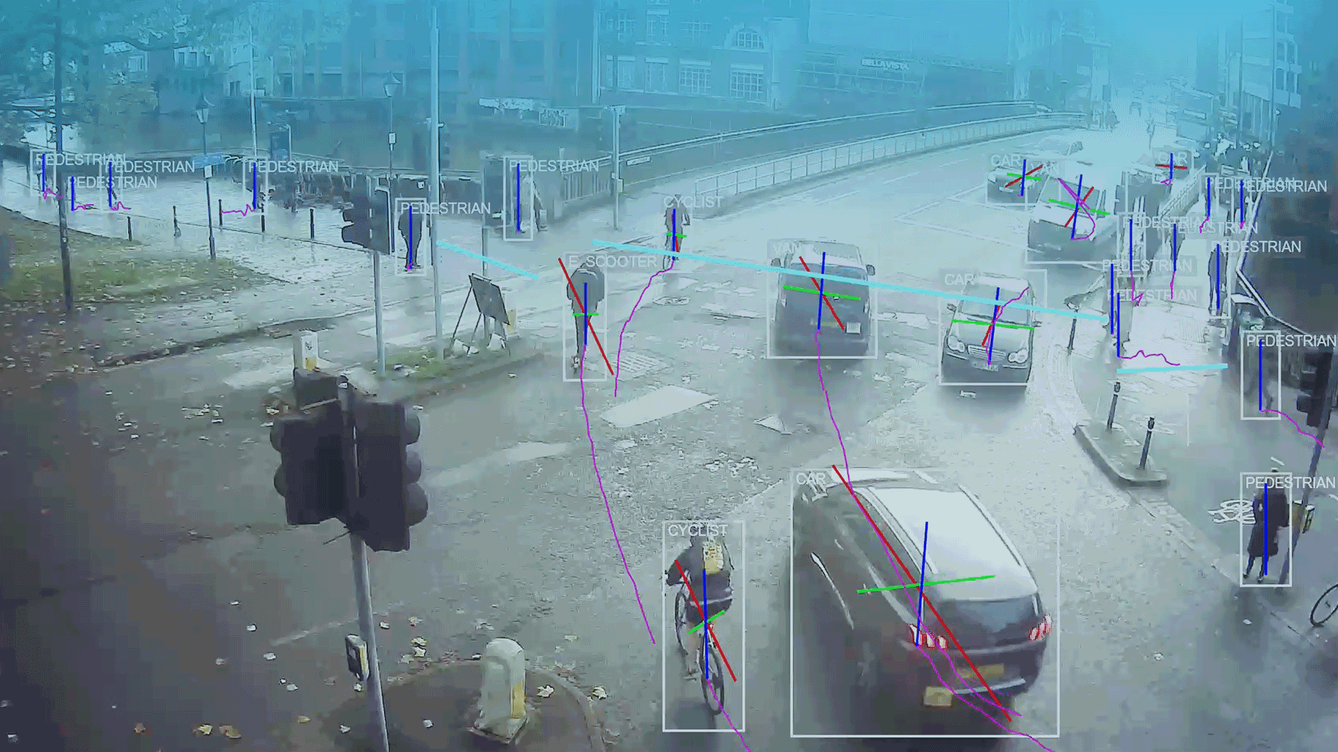
Smart Road Safety saves lives with Near Miss data.
Near Miss enables you to identify incidents that could have happened but didn’t, and the root cause of dangerous interactions.
This revolutionary dataset, combined with Speed, Tracks and the full Smart Traffic Monitoring suite, enables strategic planning and implementation of life saving schemes and initiatives without relying on killed and seriously injured (KSI) metrics, police reports and anecdotal evidence.
Be proactive, pre-emptive and targeted with your road safety schemes. Join the Smart Road Safety revolution.
VivaCity Dataset and Features for Smart Road Safety
Our AI-powered computer vision sensors offer a range features that are used to monitor and enhance Road Safety programmes:
Speed: Enables analysis on the average speed and distribution data for different classes of road users
Near Miss: Identify incident hotspots and hazardous areas before they become KSIs
Turning Counts: Enables analysis on the volume, movement and behaviour of different classes of road user
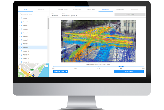
Tracks: View the paths objects make across the road
![]()
How VivaCity can support your road safety ambitions
Our game-changing Smart Road Safety solution offers a complete package of road safety metrics to support proactive road safety management. Explore the benefits of using Smart Road Safety.
Understand trends of yielding behaviours at pedestrian crossings
Define zones surrounding new pedestrian crossing infrastructure to analyse occupancy, movement and speed data to understand Give Way behaviours.
Transport for Wales’ landmark road safety initiative, the side road zebra crossing trial, is using VivaCity data to monitor impact
Implement targeted road safety measures at the most critical parts of your network
Identify the root cause of near miss incidents involving cyclists and vehicles, and incident trends across the day, week, month and year. Use these insights to develop targeted interventions that mitigate collisions and measure their success with long-term monitoring.
Monitoring turning behaviours at junctions to identify hazards
Implement detection zones at junction arms to understand how the junction operates and performs and identify any road safety risks.
Sutton Council are using Turning Counts data to monitor restricted movements to quantify dangerous movements
Bolster Monitoring & Evaluation responses for funding bids
Optimised for long-term monitoring, capture baseline data pre- intervention and continuous 24/7 data post-intervention to satisfy Monitoring & Evaluation requirements.
Learn more about how VivaCity can supporting funding bids
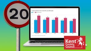
Gain a holistic understanding of how reduced speed limits impact motorists’ behaviour and active travel activity
Monitor average speed data for different road user classes to support the analysis of speed reduction interventions and inform the introduction of future ones. This could be new 20mph zones or infrastructure adaptations, like gateways, road narrowings or markings.
Use Countline Speeds for average speed metrics. Assess whether certain vehicle classes are travelling at unsafe speeds and identify when and where this is occurring most frequently.
Correlate speed and classified count data to demonstrate the impact of reducing speeds on active travel levels, at either localised sites or across your network.
Kent County Council used VivaCity speed data to evaluate 20mph trials’ impact on average speeds, with particular focus on roads near schools
Optimise pedestrian crossing infrastructure based on desire lines on busy roads
Visualise pedestrian desire lines, identify key crossing points and assess how prescribed crossings are used. With these insights, improve pedestrian safety by implementing optimised crossing infrastructure based on behavioural evidence.
West Sussex County Council are using tracks data to decide if further pedestrian crossing infrastructure is needed on a busy road.